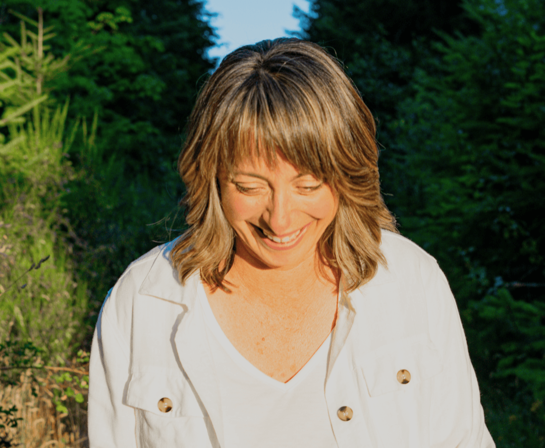
My Solo Walk on the Vancouver Island Trail
“Don’t be scared to walk alone. Don’t be scared to like it.”
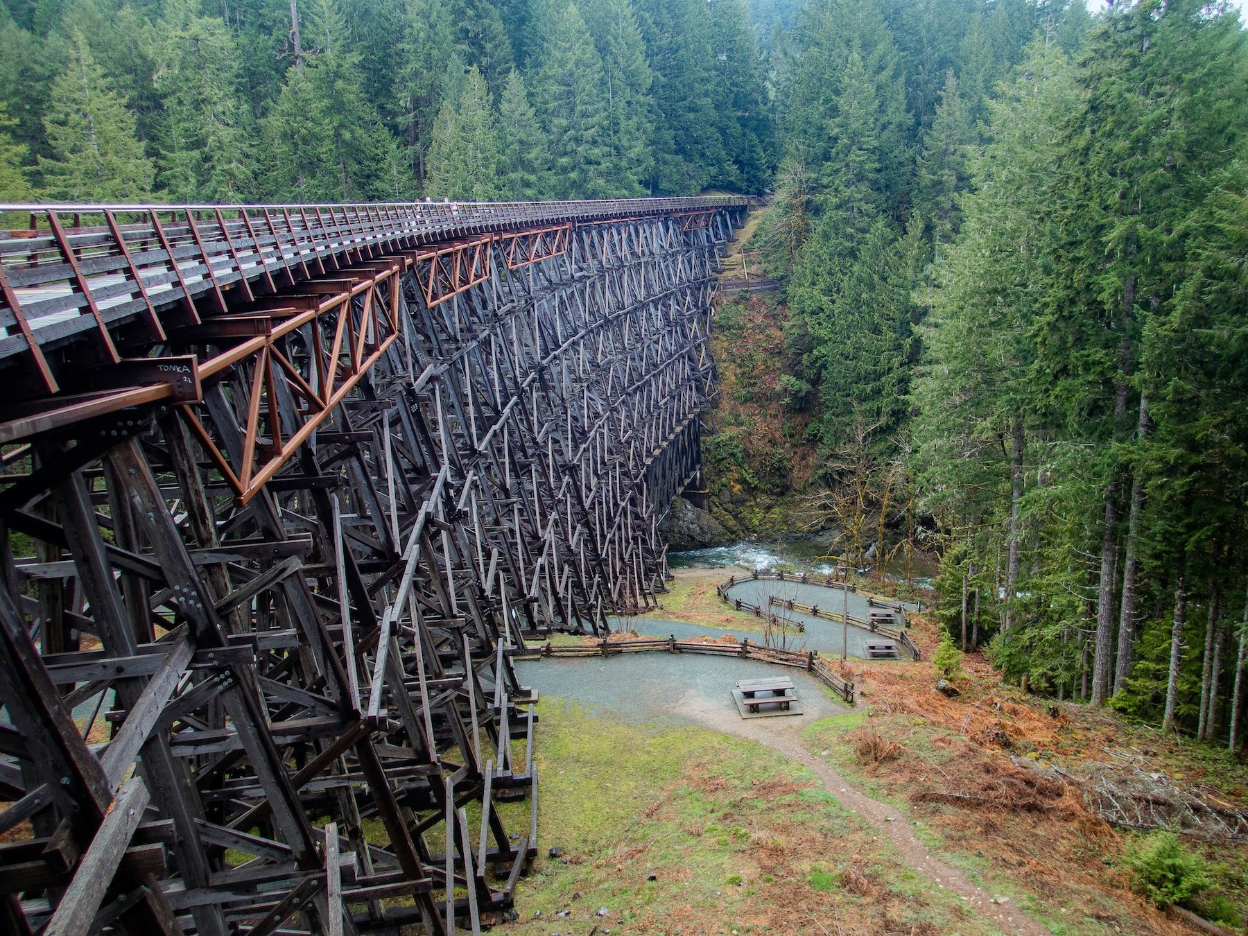
Kinsol Trestle near Shawnigan Lake along the Vancouver Island trail.
Vancouver Island is a nature and outdoor lover’s paradise! With many ways to actively explore its rugged beauty, spending time deep in the forest on a solo walk is my idea of a soul filling adventure.
The Vancouver Island Trail, also known as the VI Spine Trail, pieces together urban and wilderness trails and logging roads for 800 km stretching from the southern tip of Vancouver Island in Victoria to the island’s north coast at Cape Scott. Complete the entire trail in about a month. For non-motorized use only, the trail continues to be developed and work is led by volunteers following the vision of Gil Parker, a Canadian rock climber and hiker.
My DIY version of an ‘inn-to-inn’ solo walking route
Unlike Europe, where inn-to-inn walking is common, much of the VI-Trail goes through deep wilderness areas and requires backcountry camping. My planning challenge was to focus on a segment of the trail that was unfamiliar and did not require me to camp. Tapping into my love for travel planning, I plotted the trail with achievable distances and easy access to accommodation. I went with AirBnB’s and used the map function to search for places. I created a four-day, 82 km solo walk starting in the City of Langford and ending in the Town of Lake Cowichan.
Maps and Resources
I used the pro-version of the AllTrails app during my trip planning to download maps and used my phone’s GPS to track my progress during the journey because much of the trail doesn’t have cell service. I stitched together three AllTrails maps to construct my route. If you have the app, you can search these by name.

The path is incredibly well marked and has very few branching paths.
Humpback to Goldstream Heights via Trans Canada Trail
Cowichan Valley Trail: Malahat Connector
Trans Canada Trail: Cowichan Valley (I ended in Lake Cowichan)
It is smart and safe to have maps, but truth be told, it would be very difficult to get lost on this portion of the trail. When paths do cross, clear signage keeps you going in the right direction. Additionally, the AllTrails app sends a little warning message if you stray off the route. I tested that function at home first! I did get turned around in the final 30 minutes as I entered the town of Lake Cowichan. I had muted my phone so wasn’t alerted when the Alltrails app sent the warning message! I ended up talking with a friendly teenager who straightened me out! The takeaway, if you fear getting lost on a solo walk, is to keep your phone’s sound on!
Trail Difficulty
In my research of the trail I felt there were a lot of mixed messages about the trail’s difficulty level. I appreciate people’s reviews but know that abilities and hiking experiences vary greatly. For me, the solo experience was more important than the physical challenge. (Read more why I chose to do this hike.)
Here is my experience as a ‘midlife’ woman in reasonable shape on her premiere solo walking adventure:
Solo Walk Day 1: Langford to Goldstream Heights

Start at Sooke Wilderness Regional Park parking lot on Humpback Road in Langford
End at Trail Way in Goldstream Heights
Distance 12.5 km
Note: the official starting point is Clover Point in downtown Victoria. Clover Point to Humpback Road offers an urban walk of 29 km through Greater Victoria.
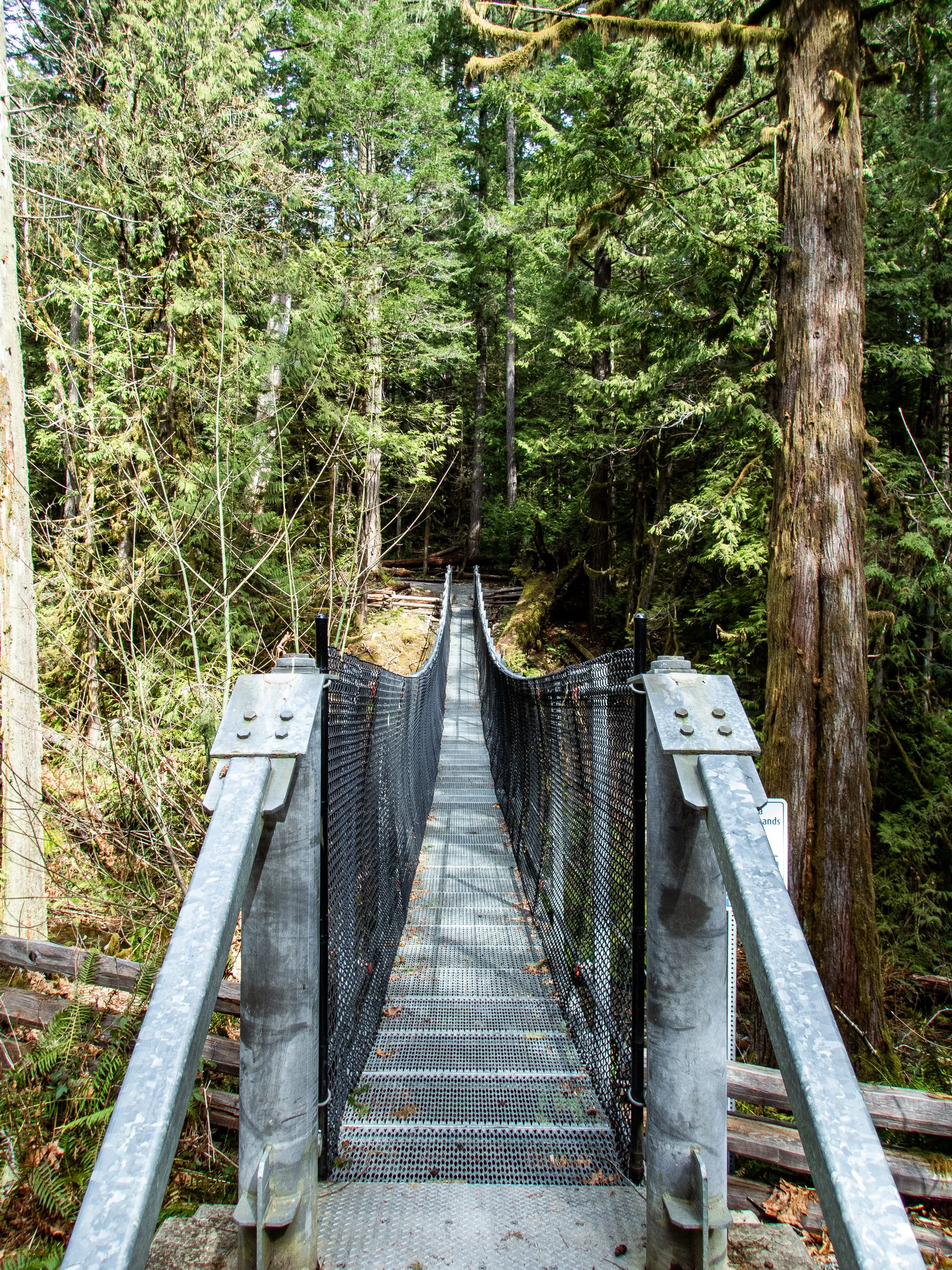
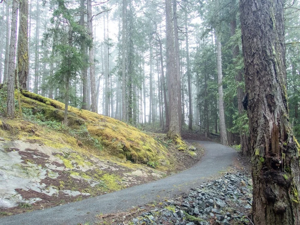
From the parking lot of the Sooke Wilderness Regional Park, the Sooke Wilderness Trail heads north along a wide, crushed gravel path. The first 2.5 km close to the city is breathtaking. Giant mature trees and a carpet of ferns frame the sculpted, windey, path to a suspension bridge and pretty waterfall.


The Climb

After the waterfall the trail goes through Victoria Watershed land following a service road that is rarely used.
The forest subtly changes with the increasing elevation and is beautiful when you pay attention! This section is where the climb begins in earnest. In my research, I was bombarded with different messages about the climb: easy; challenging; straight up for 6km (!); only for experienced hikers and bikers! My anxiety got the best of me and I readied myself for an epic challenge. So much so that I opted to have my heavy pack delivered to my evening’s destination. In hindsight, that probably wasn’t necessary but it made for a lighter, carefree and happy hike! It turns out that there is just one tough kilometer at the beginning where the incline is steady and ranges from an 11-25% grade. Then it becomes a slightly gentler incline scattered with a couple short, steeper sections for the remaining 7 km to the summit.
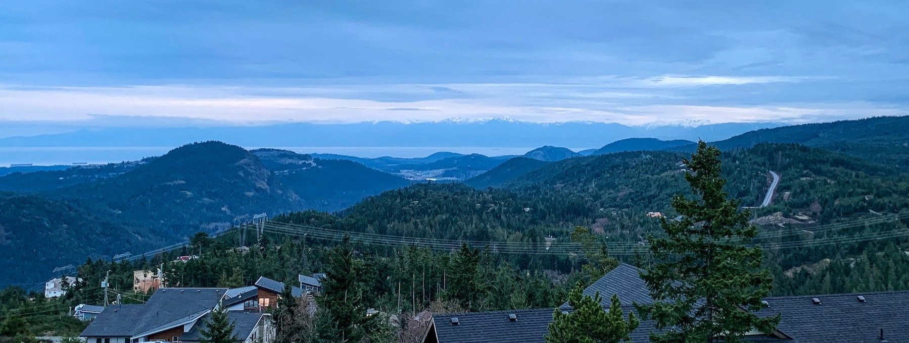
Past the north gate, the trail continues to be large and wide which brings a strange city vibe into the wilderness. The summit is sparsely treed and open and would be sweltering on a hot day. You get few glimpses of the ocean view from the path so scramble up some rocks to see across Johnston straight to the Gulf and San Juan islands.
The summit has a modest ‘top of the world’ vibe, and then to validate this, you descend sharply to Trail Way Road which was the end of my day.
I found an AirBnB with spectacular views about 2.5km away from the trail for my first night.
Solo Walk Day 2: Goldstream Heights to Shawnigan Lake
Start at Trail Way in Goldstream Heights
End at Shawnigan Lake
Distance 25 km
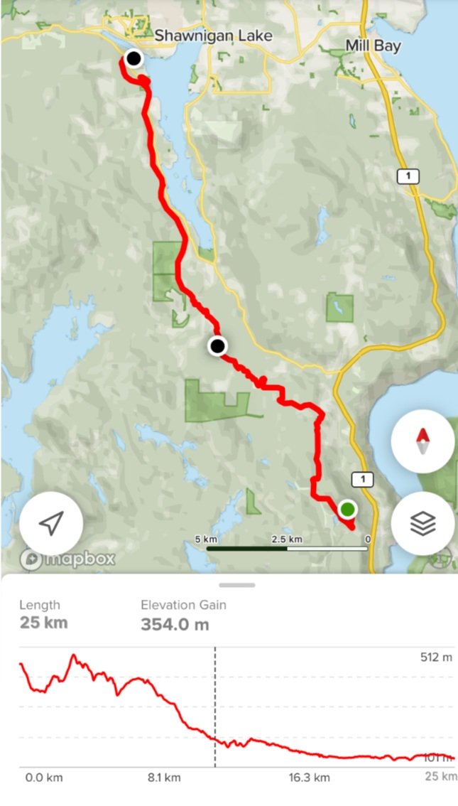
I sat drinking my coffee in bed watching as wispy clouds weaving between the layered hills gradually took over the entire scene until the window became a block of solid, soft gray. The weather felt like a message: Day 2 was NOT going to be a day for vistas, vision or clarity but for soft (and wet) introspection.
I walked the kilometers from my airbnb accommodation back to Trail Way. This was the end of the Sooke Wilderness Trail so then followed the 8km of the Malahat Connector to reach the start of the Cowichan Valley Trail system. I was pleasantly surprised that the connector was a mix of terrain including and an easy scramble up a narrow single track. On a clear day, I am sure the view is breathtaking - all I saw was gray!
The Cowichan Valley Trail system begins at Finlayson View Place where the trail soon descends deeper into the forest. The wet glistened off the bushes, leaves and tree bark. The frogs were in their glory singing acapella while birds flitted in and out of the bushes. You could hear and see the occasional eagle.
A Special Spot
At the bottom of the descent, the path and trees are stunning and join up to follow Shawnigan Creek. At a small bridge, the Malahat Nation have erected a totem pole, called the Yos Pole. The carving was completed by master carvers from Tla-o-qui-aht First Nation (Tofino), Stz’uminus First Nation (Chemainus) and various Malahat Nation youth. It has a thunderbird on one side greeting travellers and the Sasquatch with two children on the other side gazing into the forest. The legend is that Sasquatch kidnapped the two children and they stayed with her in the mountains until they were able to escape by rubbing pitch into the creature's eyes (brave, clever kids!). It feels like a special and sacred place. A tranquil spot for water, nourishment and reflection.
Over the bridge, the path changes again and soon becomes a very (very) flat journey all the way to Lake Cowichan. On one hand, you could say the lack of elevation change is monotonous but there are nuances to notice as the kilometers click away. My second night's accommodation was an AirBnB along Shawnigan Lake, close enough to the community to get dinner delivered and only a short deviation from the trail.


Does the idea of a solo journey catch your interest?
I help women over 50 take their first solo journey (and it doesn’t have to look like mine!) in The Go Solo & Thrive Project. Check it out here
Solo Walk Day 3: Shawnigan Lake to Mile 66 Trestle

Start at Shawnigan Lake
End at Mile 66 Trestle
Distance 32 km
My least favourite section of the trail was the path behind the homes at Shawnigan Lake. The trail felt more like a back alley road than a path. But this ends when you get to Kinsol Trestle, an incredible location with an interesting history. It is one of the tallest free-standing, timber rail trestle structures in the world. Finished in 1920, the trestle spans 188 metres (617 feet) over the Koksilah River. Being there first thing in the morning (in March) means this special place is almost deserted except for early morning dog walkers.
The trail from the Trestle to Glenora Park lost the previous monotony and became serene and varied, sometimes in forest and sometimes passing farmland. I sensed spring around the corner and could see how the landscape would look very different with the passage of the seasons. I could almost smell the sweet fragrance of wildflowers and berries that would show up later in the summer.

It was a Saturday and I found myself sharing the trail near the city of Duncan with a miniature horse event.
I reached Glenora Park in good time. I had left my itinerary open to complete two 20 km days or to go further on day 3 to allow the final day to be shorter. The weather was good and I was feeling great so it was decided that the extra 10km to Mile 66 Trestle would happen. I took a break at Glenora Park to sit at a picnic table, eat, drink, change my socks and find an outhouse!
The additional leg was through another glorious west coast forest. This time following (not always closely) the mighty Cowichan River. It was tempting to go on a side trip down the well marked Cowichan River Footpath but decided to save that for another time.
For the final night I was treated to a fully set up camp site at nearby (by car) Stolz Pool Provincial Park. My solo walking journey was delightfully interrupted by a BBQ dinner and great local craft beer with my husband who had been fly fishing on the Cowichan River while I walked.


Solo Walk Day 4: Mile 66 Trestle to Lake Cowichan
Start at Mile 66 Trestle
End at the town of Lake Cowichan
Distance 12.5 km
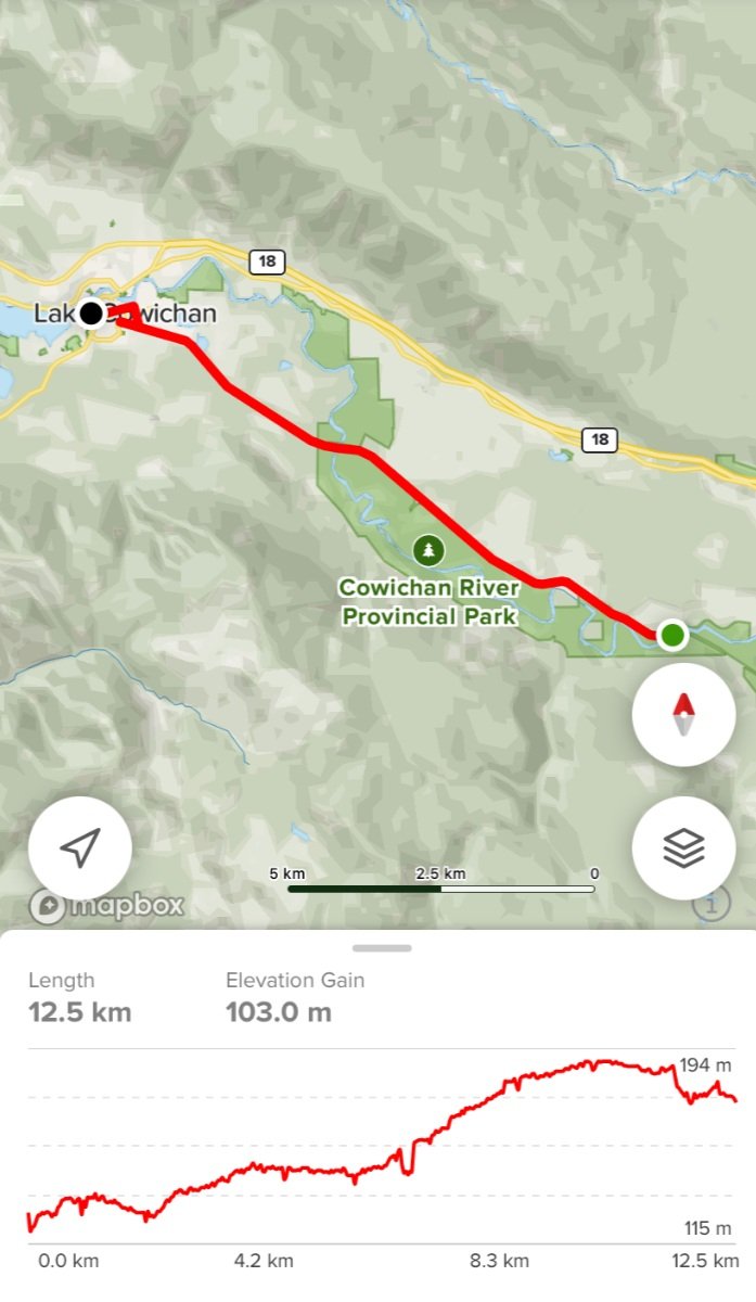
The final stretch of my journey continued along the trail that hugged a steep hillside with enormous trees on one side and dropped steeply into the river valley on the other. This section of the path has wonderful waterfalls and creeks and you can see active logging and various stages of reforested hills in the distance.
At this time of the year, parts of the river are almost white, making a cloudy aqua ribbon due to the tremendous amount of clay in the river banks. There are a few areas (trails and campsites) cordoned off as the powerful river is literally changing the landscape and the banks have become destabilized.
The most spectacular moment of the day was the 70 mile trestle because it passes high over this beautiful river. While not as structurally breathtaking as the Kinsol Trestle, it is gorgeous. There is no parking lot or access point nearby so you share the spot with only hikers, bikers and equestrians, or in my experience, have the place to yourself!
The Cowichan Valley Trail ends in the small town of Lake Cowichan. For those looking to go further, The VI Trail continues northwest around Lake Cowichan towards the Alberni Inlet. Alternately, the Trans Canada Trail heads northeast to Ladysmith and Nanaimo before hopping on a ferry to journey across the mainland of Canada.


Did I feel safe being solo?
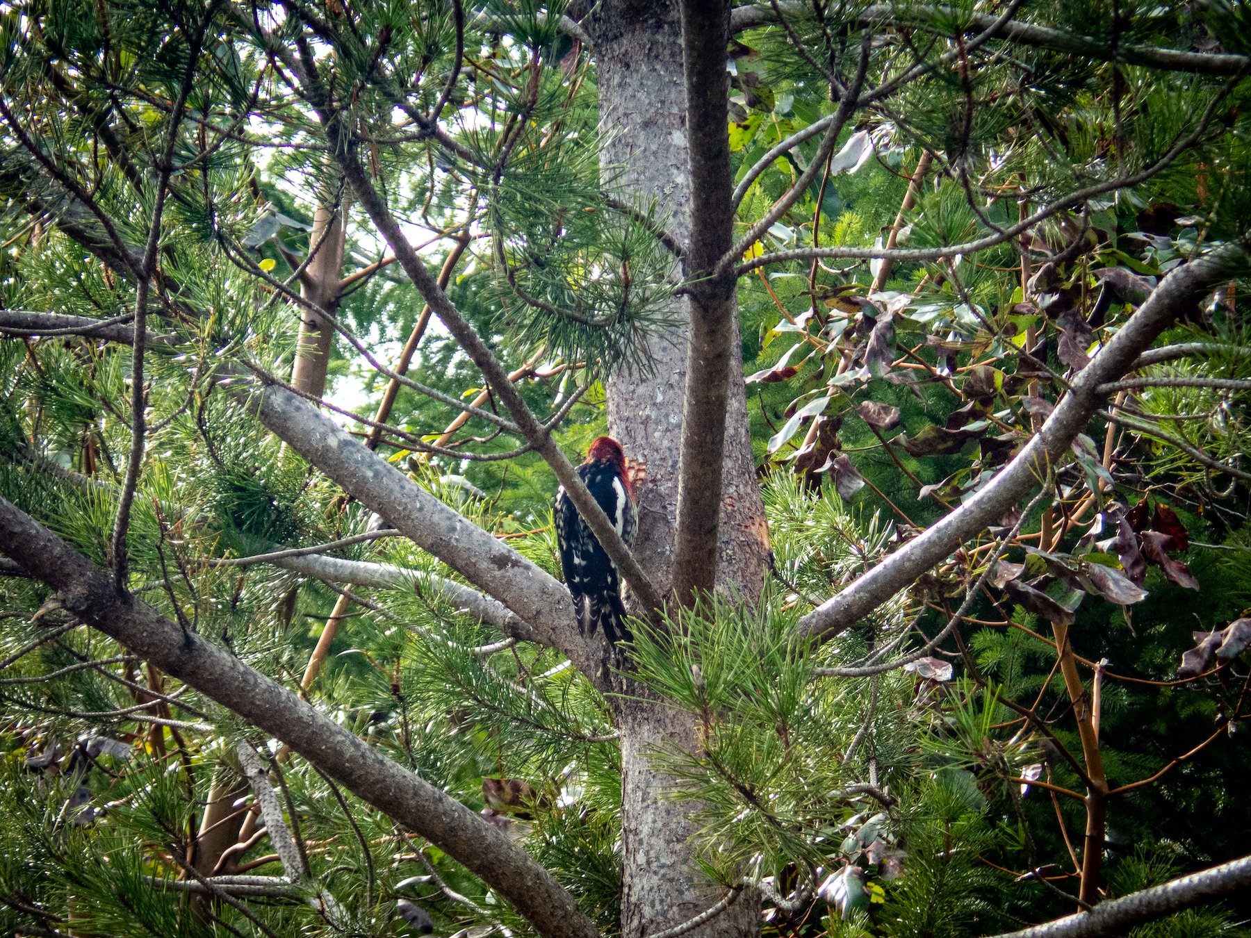
Absolutely! I was fully aware that I was going to be spending time in bear and cougar country alone so equipped myself with a bear bell, a safety whistle, bear spray and some knowledge. I learned enough about west coast wildlife to ease my mind that I knew how to avoid encounters and what to do in case I came across an animal. It turned out that I experienced only bird wildlife encounters and didn’t even see scat or footprint evidence of bears or cougars.
In all honesty, I did have 10 minutes of uncertainty on my second day. It was foggy, raining lightly and I kept hearing a noise behind me. After a few spins around to look, I realized the sound I heard was my ponytail rubbing against my rain jacket hood! A good laugh at myself went a long way as a reminder that I was prepared, capable and safe.
JFDI - Solo walk your way!
If you are interested in a multi-day solo walk, I hope that my modest journey helps you to imagine something achievable for yourself. I encourage you to get ideas from mine but to design your own journey by integrating your own comfort zone challenges. For me, on this trip, it was going solo. For you it might be reaching a summit, backcountry camping, technical hiking… tailor the list to you. One of the best parts of the experience were the weeks before I packed my bags, the planning and preparation helped to customize, personalize and choose my own adventure.
Happy Travels!
Let me know if you check out this trail or create your own version!

Pin it for later!